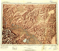
1955 Map of Nabesna D-3
USGS Topo · Published 1958About this map
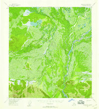
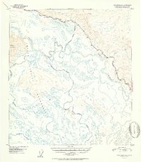
The Nabesna River dominates this interior landscape, winding through a complex network of braided channels and marshes within the Tetlin Indian Reservation. This 1955 survey, based on aerial photography from the previous year, documents a largely roadless expanse where water and terrain dictate movement. The river’s path is flanked by the Nabesna Slough, illustrating the dynamic nature of the Alaskan wetlands and the shifting alluvial patterns of the Fourth Judicial Division. A single marked Trail represents the only overland transportation infrastructure shown, indicating a region where traditional land use and seasonal waterways remained the primary means of traversal. The topography transitions from low-lying swamp and brush to significant elevation gains, providing a clear record of the boundary between the river valley and the rising upland interior.
Find a feature on this map
4 named features on this map. Tap any name to fly to it.
Don’t see what you’re looking for? This feature index may not catch every label — zoom into the map to look around manually.
Map Details
Editions of this 1955 Nabesna D-3 Map
2 editions found

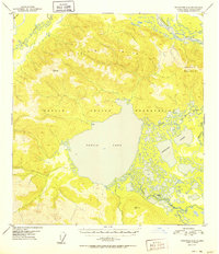
Other maps of this area
1948 · Tanacross A-3
USGS Topo · 1:63,360
1948 · Tanacross A-4
USGS Topo · 1:63,360
1949 · Tanacross
USGS Topo · 1:250,000
1950 · Tanacross
USGS Topo · 1:250,000
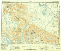
1950 · Nabesna
USGS Topo · 1:250,000
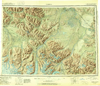
1951 · Nabesna
USGS Topo · 1:250,000
1952 · Tanacross A-4
USGS Topo · 1:63,360
1952 · Tanacross A-3
USGS Topo · 1:63,360

1954 · Tanacross A-2
USGS Topo · 1:63,360

1954 · Nabesna D-2
USGS Topo · 1:63,360