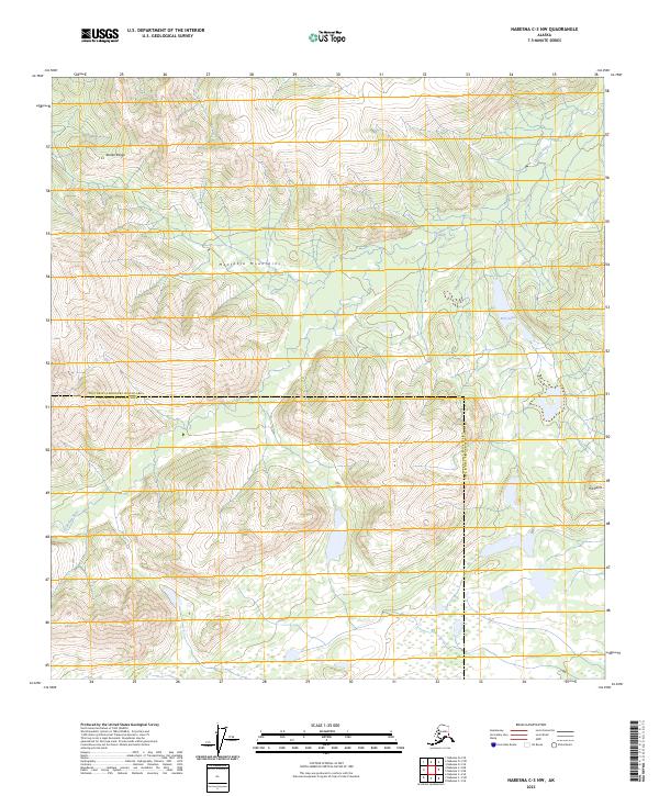
2023 Map of Nabesna C-3 NW
USGS Topo · Published 2023About this map
The Cheslina River winds through this high-altitude landscape where the southern reaches of the Alaska Range meet the Mentasta Mountains. This 2023 survey documents a remote wilderness straddling the boundary between the Southeast Fairbanks Census Area and the Copper River Census Area. Much of the eastern portion of the sheet is protected within the Tetlin National Wildlife Refuge, an area defined by glacial hydrology and extreme topography. Researchers will find a pristine environment dominated by peaks such as Hill Point and isolated water bodies like Fern Lake, illustrating the complex drainage patterns of interior Alaska before any significant human development or infrastructure was established in these high mountain passes.
Find a feature on this map
11 named features on this map. Tap any name to fly to it.
Don’t see what you’re looking for? This feature index may not catch every label — zoom into the map to look around manually.
Map Details
Editions of this 2023 Nabesna C-3 NW Map
This is the sole edition of this map. No revisions or reprints were ever made.
Other maps of this area

1950 · Nabesna
USGS Topo · 1:250,000

1951 · Nabesna
USGS Topo · 1:250,000

1954 · Nabesna D-3
USGS Topo · 1:63,360

1954 · Nabesna C-3
USGS Topo · 1:63,360

1954 · Nabesna D-4
USGS Topo · 1:63,360

1955 · Nabesna D-3
USGS Topo · 1:63,360

1955 · Nabesna C-3
USGS Topo · 1:63,360
1960 · Nabesna D-4
USGS Topo · 1:63,360

1960 · Nabesna
USGS Topo · 1:250,000

1960 · Nabesna C-4
USGS Topo · 1:63,360