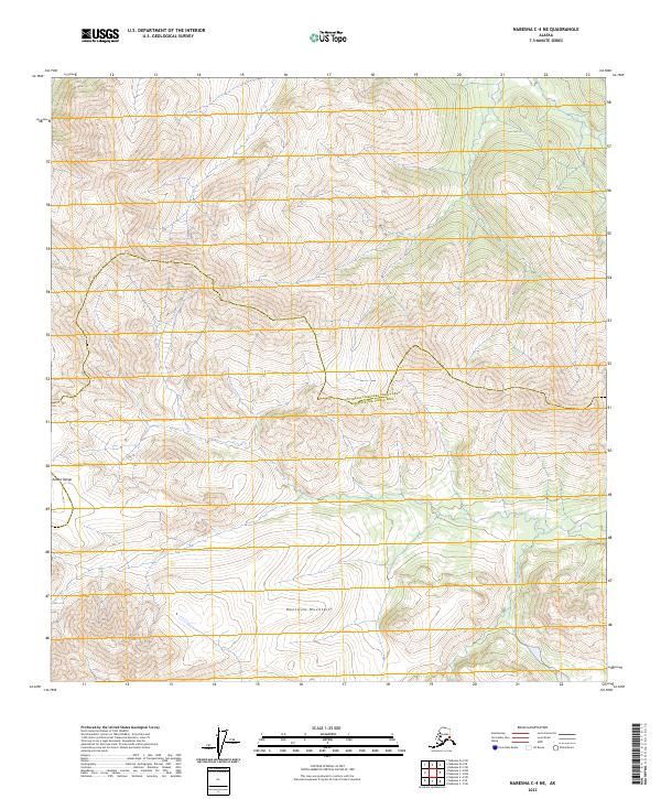
2023 Map of Nabesna C-4 NE
USGS Topo · Published 2023About this map
The Alaska Range and Mentasta Mountains dominate this high-altitude landscape, where the southern boundary of the Southeast Fairbanks Census Area Copper River Census Area marks a significant administrative divide. To the southeast, the protected wilderness of the Tetlin National Wildlife Refuge provides a preserve for subarctic ecosystems and local hydrology. The Cheslina River cuts through the lower elevations in the southeast corner, representing a critical water source in an otherwise high-relief terrain. The map's contour lines illustrate the complex drainage patterns and ridgelines that separate the major mountain systems, showcasing the transition between the high peaks and the river valleys that define this part of the Alaskan interior.
Find a feature on this map
9 named features on this map. Tap any name to fly to it.
Don’t see what you’re looking for? This feature index may not catch every label — zoom into the map to look around manually.
Map Details
Editions of this 2023 Nabesna C-4 NE Map
This is the sole edition of this map. No revisions or reprints were ever made.
Other maps of this area

1950 · Nabesna
USGS Topo · 1:250,000

1951 · Nabesna
USGS Topo · 1:250,000

1954 · Nabesna D-3
USGS Topo · 1:63,360

1954 · Nabesna C-3
USGS Topo · 1:63,360

1954 · Nabesna D-4
USGS Topo · 1:63,360

1955 · Nabesna D-3
USGS Topo · 1:63,360

1955 · Nabesna C-3
USGS Topo · 1:63,360
1960 · Nabesna D-4
USGS Topo · 1:63,360

1960 · Nabesna
USGS Topo · 1:250,000

1960 · Nabesna C-4
USGS Topo · 1:63,360