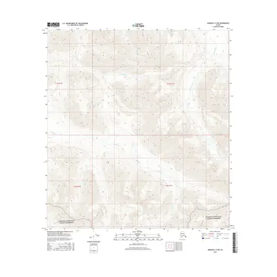
2016 Map of Nabesna C-5 NW
USGS Topo · Published 2016About this map
Wrangell-Saint Elias National Preserve occupies the southern portion of this remote Alaskan terrain, where high-elevation drainage patterns define the landscape. The geography is characterized by the headwaters and meandering paths of several significant waterways, including the Little Tok River in the northeast and Suslositna Creek flowing through the central valley. These glacial-fed streams are joined by Suslota Creek and Trail Creek, illustrating a complex hydrologic network that has shaped this interior region. The lack of named settlements or roads reflects the protected status and wilderness character of the preserve, where natural boundaries are defined by the township lines of T11N R10E and T11N R11E. This map provides a precise record of the topographical contours and waterway orientations within this massive conservation area as they existed in the early 21st century.
Find a feature on this map
9 named features on this map. Tap any name to fly to it.
Don’t see what you’re looking for? This feature index may not catch every label — zoom into the map to look around manually.
Map Details
Editions of this 2016 Nabesna C-5 NW Map
This is the sole edition of this map. No revisions or reprints were ever made.
Other maps of this area

1948 · Nabesna C-6
USGS Topo · 1:63,360

1948 · Nabesna D-5
USGS Topo · 1:63,360

1949 · Nabesna D-6
USGS Topo · 1:63,360

1950 · Nabesna
USGS Topo · 1:250,000

1950 · Nabesna D-5
USGS Topo · 1:63,360

1951 · Nabesna
USGS Topo · 1:250,000

1952 · Nabesna C-6
USGS Topo · 1:63,360

1952 · Nabesna D-5
USGS Topo · 1:63,360

1952 · Nabesna D-6
USGS Topo · 1:63,360

1957 · Nabesna C-5
USGS Topo · 1:63,360