
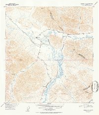
1952 Map of Nabesna D-6
USGS Topo · Published 1952About this map
The settlement at Mentasta Lake and the nearby Bear Cub Inn anchor this 1950s study of the northern Mentasta Mountains. The landscape is defined by the winding Slana River and its numerous tributaries, including Suslostina Creek and Mentasta Creek. A critical transit point, the area shows the early infrastructure of the Glenn Highway as it cuts through Mentasta Pass, paralleling older routes like the Tractor Trail and the historic Eagle Trail. One section of the highway is notably marked as being under construction, signaling a period of postwar development in this interior region. Notable landmarks for local history include an abandoned Cabin and high mountain peaks such as Siko and Ansell, which served as key surveying points for the Geological Survey.
Find a feature on this map
26 named features on this map. Tap any name to fly to it.
Don’t see what you’re looking for? This feature index may not catch every label — zoom into the map to look around manually.
Map Details
Editions of this 1952 Nabesna D-6 Map
2 editions found
Other maps of this area

1948 · Tanacross A-6
USGS Topo · 1:63,360

1948 · Nabesna C-6
USGS Topo · 1:63,360

1948 · Nabesna D-5
USGS Topo · 1:63,360

1948 · Tanacross A-5
USGS Topo · 1:63,360

1949 · Tanacross
USGS Topo · 1:250,000

1949 · Nabesna D-6
USGS Topo · 1:63,360

1949 · Tanacross A-5
USGS Topo · 1:63,360

1949 · Gulkana C-1
USGS Topo · 1:63,360

1949 · Mt. Hayes A-1
USGS Topo · 1:63,360

1950 · Tanacross
USGS Topo · 1:250,000