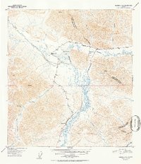
1952 Map of Nabesna D-6
USGS Topo · Published 1952About this map
Mentasta Lake and its surrounding mountain passes define this interior landscape during a period of infrastructure expansion in the early fifties. The Glenn Highway cuts through the territory, shown with sections still listed as being under construction as it follows the path of the Slana River. This roadway mirrors the older terrestrial routes that previously dominated travel, such as the Eagle Trail and various stretches of Tractor Trail used for overland transport.
Find a feature on this map
22 named features on this map. Tap any name to fly to it.
Don’t see what you’re looking for? This feature index may not catch every label — zoom into the map to look around manually.
Map Details
Editions of this 1952 Nabesna D-6 Map
2 editions found

Other maps of this area

1948 · Tanacross A-6
USGS Topo · 1:63,360

1948 · Nabesna C-6
USGS Topo · 1:63,360

1948 · Nabesna D-5
USGS Topo · 1:63,360

1948 · Tanacross A-5
USGS Topo · 1:63,360

1949 · Tanacross
USGS Topo · 1:250,000

1949 · Nabesna D-6
USGS Topo · 1:63,360

1949 · Tanacross A-5
USGS Topo · 1:63,360

1949 · Gulkana C-1
USGS Topo · 1:63,360

1949 · Mt. Hayes A-1
USGS Topo · 1:63,360

1950 · Tanacross
USGS Topo · 1:250,000