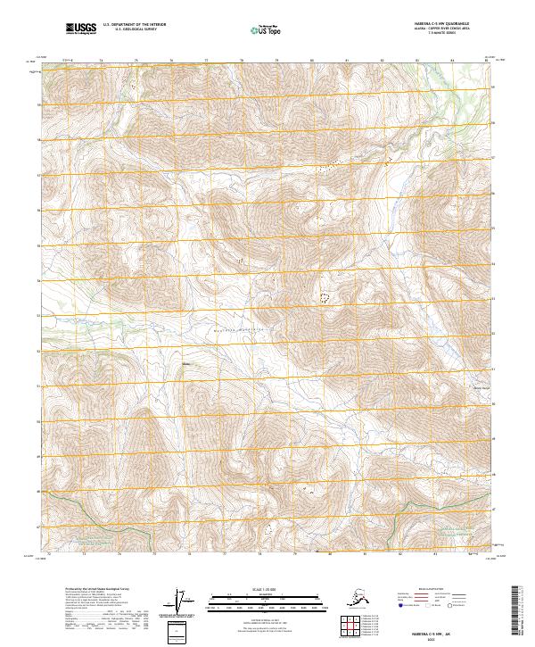
2023 Map of Nabesna C-5 NW
USGS Topo · Published 2023About this map
The Mentasta Mountains and the northern reaches of the Alaska Range converge in this high-altitude Alaskan landscape, where the settlement of Slana occupies the lower valley floors. This 2023 survey delineates the intricate drainage patterns of Suslota Creek as it winds toward the interior, contrasted by the Little Tok River in the northeastern corner. Much of the southern terrain is protected within the Wrangell-Saint Elias National Preserve, a designation that governs the land use and preservation of this wilderness interface. The map documents the relationship between these federal lands and the drainage of Trail Creek, providing a precise record of the topography and public land survey system boundaries across townships such as t11n r11e.
Find a feature on this map
11 named features on this map. Tap any name to fly to it.
Don’t see what you’re looking for? This feature index may not catch every label — zoom into the map to look around manually.
Map Details
Editions of this 2023 Nabesna C-5 NW Map
This is the sole edition of this map. No revisions or reprints were ever made.
Other maps of this area

1948 · Nabesna C-6
USGS Topo · 1:63,360

1948 · Nabesna D-5
USGS Topo · 1:63,360

1949 · Nabesna D-6
USGS Topo · 1:63,360

1950 · Nabesna
USGS Topo · 1:250,000

1950 · Nabesna D-5
USGS Topo · 1:63,360

1951 · Nabesna
USGS Topo · 1:250,000

1952 · Nabesna C-6
USGS Topo · 1:63,360

1952 · Nabesna D-5
USGS Topo · 1:63,360

1952 · Nabesna D-6
USGS Topo · 1:63,360

1957 · Nabesna C-5
USGS Topo · 1:63,360