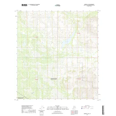
2019 Map of Nabesna C-6 NE
USGS Topo · Published 2019About this map
Wrangell-St. Elias National Preserve and the adjoining Wrangell-St. Elias National Park define this interior Alaskan landscape, where the northern slopes of the Mentasta Mountains meet a network of high-latitude wetlands. The cartography illustrates a transition from the elevated peaks in the southeast to a broad valley floor dominated by Suslota Lake. Transport into this wilderness is dictated by the Nabesna Road in the southwest corner, which serves as a primary artery for those accessing the preserve. From this road, the Suslota Lake Trail strikes northward toward the water, following the drainage of Suslota Cr. This area remains largely undeveloped, characterized by the intricate braiding of Natat Cr and the vast marshes that surround the central lake system.
Find a feature on this map
12 named features on this map. Tap any name to fly to it.
Don’t see what you’re looking for? This feature index may not catch every label — zoom into the map to look around manually.
Map Details
Editions of this 2019 Nabesna C-6 NE Map
This is the sole edition of this map. No revisions or reprints were ever made.
Other maps of this area

1948 · Nabesna C-6
USGS Topo · 1:63,360

1948 · Nabesna D-5
USGS Topo · 1:63,360

1949 · Nabesna D-6
USGS Topo · 1:63,360

1950 · Nabesna
USGS Topo · 1:250,000

1950 · Nabesna D-5
USGS Topo · 1:63,360

1951 · Nabesna
USGS Topo · 1:250,000

1952 · Nabesna C-6
USGS Topo · 1:63,360

1952 · Nabesna D-5
USGS Topo · 1:63,360

1952 · Nabesna D-6
USGS Topo · 1:63,360

1957 · Nabesna C-5
USGS Topo · 1:63,360