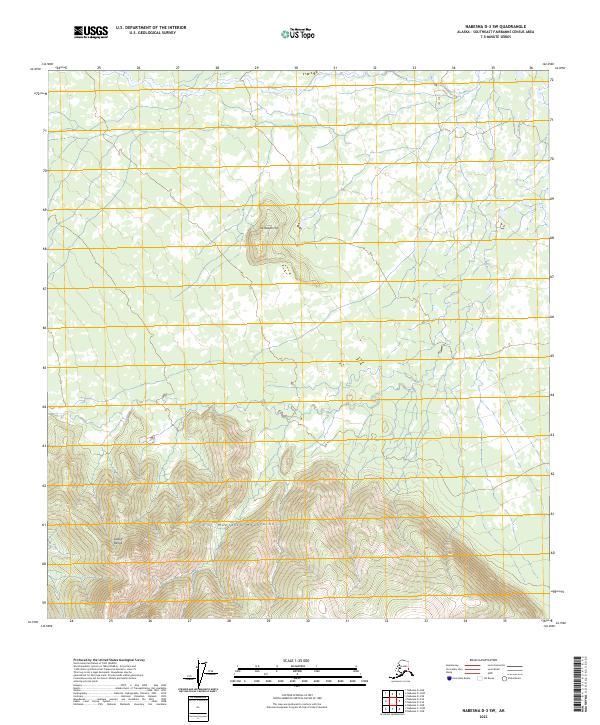
2023 Map of Nabesna D-3 SW
USGS Topo · Published 2023About this map
The Mentasta Mountains and the eastern fringes of the Alaska Range dominate this interior landscape in the Southeast Fairbanks Census Area. This 2023 survey provides a clear view of the high-altitude topography, where steep ridgelines descend into a complex network of glacial valleys and seasonal drainages. In the southeastern corner of the sheet, the protected lands of the Tetlin National Wildlife Refuge begin, marking a transition into a massive ecosystem of wetlands and forests. To the north, the isolated prominence of Taixtsalda Hill stands as a distinct landmark against the surrounding lower-lying terrain. The map is largely defined by its natural features and public land divisions, reflecting the undeveloped character of this part of the Alaskan wilderness where human infrastructure is almost entirely absent in favor of protected habitats.
Find a feature on this map
11 named features on this map. Tap any name to fly to it.
Don’t see what you’re looking for? This feature index may not catch every label — zoom into the map to look around manually.
Map Details
Editions of this 2023 Nabesna D-3 SW Map
This is the sole edition of this map. No revisions or reprints were ever made.
Other maps of this area

1950 · Nabesna
USGS Topo · 1:250,000

1951 · Nabesna
USGS Topo · 1:250,000

1954 · Nabesna D-3
USGS Topo · 1:63,360

1954 · Nabesna C-3
USGS Topo · 1:63,360

1954 · Nabesna D-4
USGS Topo · 1:63,360

1955 · Nabesna D-3
USGS Topo · 1:63,360

1955 · Nabesna C-3
USGS Topo · 1:63,360
1960 · Nabesna D-4
USGS Topo · 1:63,360

1960 · Nabesna
USGS Topo · 1:250,000

1960 · Nabesna C-4
USGS Topo · 1:63,360