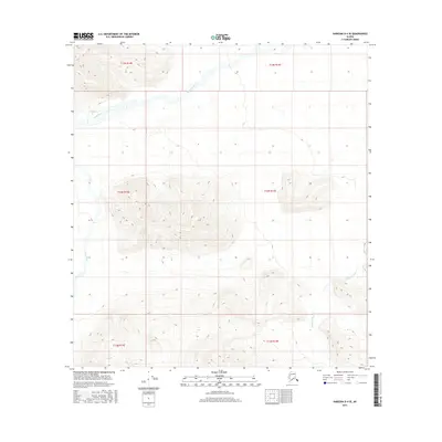
2016 Map of Nabesna D-4 SE
USGS Topo · Published 2016About this map
Tetlin River meanders across the northern reaches of this remote Alaskan interior landscape, carving a wide alluvial valley through the eastern Mentasta Mountains. The river's braided course and the surrounding marshy lowlands contrast sharply with the steep, unnamed ridgelines that dominate the central and southern portions of the quadrangle. In the southeast, the Kalukna River flows through high-elevation terrain, tracing a path between mountain flanks that reach toward the headwaters of the Copper River drainage. This 2016 survey, produced by the U.S. Geological Survey using imagery and elevation data from the early 21st century, documents a wilderness environment defined by significant vertical relief and the natural hydrography of these two distinct river systems.
Find a feature on this map
8 named features on this map. Tap any name to fly to it.
Don’t see what you’re looking for? This feature index may not catch every label — zoom into the map to look around manually.
Map Details
Editions of this 2016 Nabesna D-4 SE Map
This is the sole edition of this map. No revisions or reprints were ever made.
Other maps of this area

1950 · Nabesna
USGS Topo · 1:250,000

1951 · Nabesna
USGS Topo · 1:250,000

1954 · Nabesna D-3
USGS Topo · 1:63,360

1954 · Nabesna C-3
USGS Topo · 1:63,360

1954 · Nabesna D-4
USGS Topo · 1:63,360

1955 · Nabesna D-3
USGS Topo · 1:63,360

1955 · Nabesna C-3
USGS Topo · 1:63,360
1960 · Nabesna D-4
USGS Topo · 1:63,360

1960 · Nabesna
USGS Topo · 1:250,000

1960 · Nabesna C-4
USGS Topo · 1:63,360