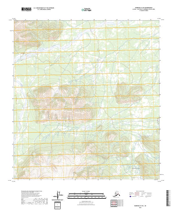
2023 Map of Nabesna D-4 SE
USGS Topo · Published 2023About this map
The Tetlin River meanders through the northern reaches of this landscape, carving a low-lying valley before the elevation climbs sharply toward the south. This transition from riverine lowlands to high-altitude terrain is defined by the northern slopes of the Mentasta Mountains, which dominate the southern half of the quadrangle. The lack of infrastructure or named settlements emphasizes the wilderness character of this part of the Southeast Fairbanks census area, where the topography is primarily shaped by glacial and fluvial forces. Boundary lines for various townships, including t13n r14e and t12n r15e, indicate the underlying survey structure used to organize this interior Alaskan corridor between the river valley and the high peaks.
Find a feature on this map
8 named features on this map. Tap any name to fly to it.
Don’t see what you’re looking for? This feature index may not catch every label — zoom into the map to look around manually.
Map Details
Editions of this 2023 Nabesna D-4 SE Map
This is the sole edition of this map. No revisions or reprints were ever made.
Other maps of this area

1950 · Nabesna
USGS Topo · 1:250,000

1951 · Nabesna
USGS Topo · 1:250,000

1954 · Nabesna D-3
USGS Topo · 1:63,360

1954 · Nabesna C-3
USGS Topo · 1:63,360

1954 · Nabesna D-4
USGS Topo · 1:63,360

1955 · Nabesna D-3
USGS Topo · 1:63,360

1955 · Nabesna C-3
USGS Topo · 1:63,360
1960 · Nabesna D-4
USGS Topo · 1:63,360

1960 · Nabesna
USGS Topo · 1:250,000

1960 · Nabesna C-4
USGS Topo · 1:63,360