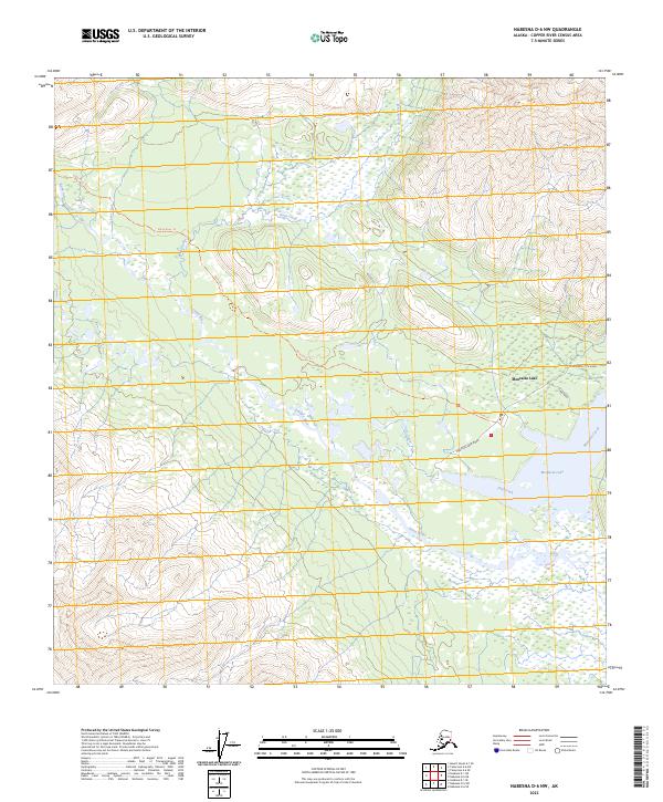
2023 Map of Nabesna D-6 NW
USGS Topo · Published 2023About this map
Slana River drainage dominates this Copper River Census Area landscape, showing the complex network of waterways and trails in the Alaska interior. The prominent Mentasta Lake serves as a central geographical marker, fed by Mentasta Creek and surrounded by a system of wetlands. Transportation in this part of the Nabesna D-6 NW quadrangle is defined by a mix of modern and traditional routes, including Mentasta Spur Road and the extensive Slana River Trl. These routes follow the natural contours of the land, providing access through the valley where Fish Creek and Bone Creek merge into the broader river system. The mapping by the U.S. Geological Survey reflects the intricate hydrography of the region, where numerous unnamed streams and ponds characterize the riparian corridors between the higher elevations of the surrounding ranges.
Find a feature on this map
15 named features on this map. Tap any name to fly to it.
Don’t see what you’re looking for? This feature index may not catch every label — zoom into the map to look around manually.
Map Details
Editions of this 2023 Nabesna D-6 NW Map
This is the sole edition of this map. No revisions or reprints were ever made.
Other maps of this area

1948 · Tanacross A-6
USGS Topo · 1:63,360

1949 · Tanacross
USGS Topo · 1:250,000

1949 · Nabesna D-6
USGS Topo · 1:63,360

1949 · Mt. Hayes A-1
USGS Topo · 1:63,360

1950 · Tanacross
USGS Topo · 1:250,000

1950 · Nabesna
USGS Topo · 1:250,000

1950 · Mount Hayes
USGS Topo · 1:250,000

1951 · Gulkana
USGS Topo · 1:250,000

1951 · Mount Hayes
USGS Topo · 1:250,000

1951 · Nabesna
USGS Topo · 1:250,000