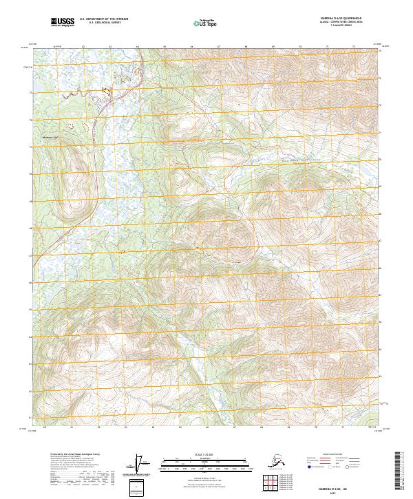
2023 Map of Nabesna D-6 SE
USGS Topo · Published 2023About this map
Mentasta Lake sits along the western edge of this Alaskan landscape, where the Tok Cutoff Highway follows the natural corridor carved by the Slana River. This region is defined by the transition from the river basin’s wetlands and the Slana Slough into the rising elevations of the Mentasta Mountains to the east. The map detail highlights the traditional routes through the interior, specifically tracing the Bear Valley Trl as it winds through Bear Valley and the Suslositna - Bear Valley Trl. These trails, along with tributaries like Mabel Creek and Suslota Creek, illustrate the historical and modern reliance on mountain passes and river valleys for navigation in the Copper River Census Area.
Find a feature on this map
17 named features on this map. Tap any name to fly to it.
Don’t see what you’re looking for? This feature index may not catch every label — zoom into the map to look around manually.
Map Details
Editions of this 2023 Nabesna D-6 SE Map
This is the sole edition of this map. No revisions or reprints were ever made.
Other maps of this area

1948 · Nabesna C-6
USGS Topo · 1:63,360

1948 · Nabesna D-5
USGS Topo · 1:63,360

1949 · Nabesna D-6
USGS Topo · 1:63,360

1950 · Nabesna
USGS Topo · 1:250,000

1950 · Nabesna D-5
USGS Topo · 1:63,360

1951 · Nabesna
USGS Topo · 1:250,000

1952 · Nabesna C-6
USGS Topo · 1:63,360

1952 · Nabesna D-5
USGS Topo · 1:63,360

1952 · Nabesna D-6
USGS Topo · 1:63,360

1957 · Nabesna C-5
USGS Topo · 1:63,360