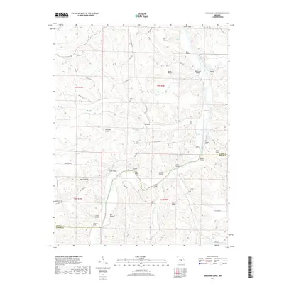
2017 Map of Nagogami Lodge
USGS Topo · Published 2017About this map
The Gasconade River winds through the border of Maries and Phelps counties, anchoring a landscape defined by steep ridges and complex hollows. Named after a fishing and hunting retreat along the riverbanks, Nagogami Lodge sits near the crossing of State Hwy E at the Gaines Ford-Br. This central Missouri topography is characterized by distinctive geological features, most notably the Clifty Creek Natural Bridge and Bell Bluff. Small agricultural and residential communities like Hayden and Stickney are connected by a network of county roads, while numerous family burial grounds, including the Granny Baker Graveyard and Fulkerson Cem, provide valuable points of interest for genealogists tracking local history. The map also reveals numerous springs such as Pemberly Spring and Parker Spring, which feed into the intricate drainage systems of Tick Cr and Little Clifty Cr.
Find a feature on this map
78 named features on this map. Tap any name to fly to it.
Don’t see what you’re looking for? This feature index may not catch every label — zoom into the map to look around manually.
Map Details
Editions of this 2017 Nagogami Lodge Map
This is the sole edition of this map. No revisions or reprints were ever made.
Other maps of this area

1888 · Tuscumbia
USGS Topo · 1:125,000

1894 · Tuscumbia
USGS Topo · 1:125,000

1912 · Rolla
USGS Topo · 1:62,500

1936 · Waynesville
USGS Topo · 1:48,000

1937 · Vienna
USGS Topo · 1:62,500

1938 · Vienna
USGS Topo · 1:48,000

1942 · Waynesville
USGS Topo · 1:62,500

1944 · Waynesville
USGS Topo · 1:62,500

1947 · Jefferson City
USGS Topo · 1:250,000

1948 · Tavern
USGS Topo · 1:62,500