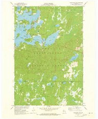
1971 Map of Namekagon Lake
USGS Topo · Published 1973About this map
Namekagon Lake and its intricate shoreline dominate the northern landscape of this early 1970s survey, defined by numerous family-named landmarks like Juneks Point and Eagle Point. The interior is largely preserved within the Chequamegon National Forest, where a complex network of smaller water bodies such as Ghost Lake, McCloud Lake, and Goodwin Lake are interspersed with wetlands and forest tracks. Local infrastructure is sparse, centered around the settlement of Namekagon and the Townhall, illustrating the rural, recreation-focused character of northern Wisconsin during this era.
Find a feature on this map
37 named features on this map. Tap any name to fly to it.
Don’t see what you’re looking for? This feature index may not catch every label — zoom into the map to look around manually.
Map Details
Editions of this 1971 Namekagon Lake Map
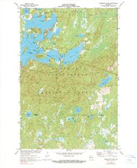
2 editions found
Other maps of this area

1942 · Clam Lake
USGS Topo · 1:48,000

1942 · Marengo
USGS Topo · 1:48,000

1943 · Namekagon Lake
USGS Topo · 1:48,000

1944 · Grandview
USGS Topo · 1:48,000

1945 · Namekagon Lake
USGS Topo · 1:48,000

1945 · Marengo
USGS Topo · 1:48,000

1945 · Clam Lake
USGS Topo · 1:48,000

1947 · Grandview
USGS Topo · 1:48,000

1953 · Ashland
USGS Topo · 1:250,000

1958 · Ashland
USGS Topo · 1:250,000