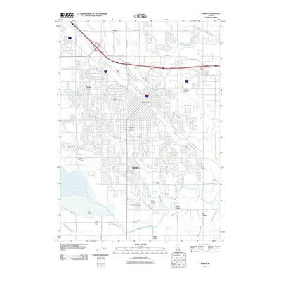
2010 Map of Nampa
USGS Topo · Published 2010About this map
The city of Nampa is defined here by its intricate network of irrigation and drainage infrastructure, reflecting its critical role in Idaho's agricultural landscape. Large water bodies like Lake Lowell dominate the southwest, while the city center is surrounded by specialized districts such as the Sugar Factory Camp and Karcher Junction. The presence of Northwest Nazarene University and the Nampa Municipal Airport highlights the city's growth as a regional hub of education and transportation.
Find a feature on this map
76 named features on this map. Tap any name to fly to it.
Don’t see what you’re looking for? This feature index may not catch every label — zoom into the map to look around manually.
Map Details
Editions of this 2010 Nampa Map
This is the sole edition of this map. No revisions or reprints were ever made.
Other maps of this area

1892 · Boise
USGS Topo · 1:125,000

1892 · Bisuka
USGS Topo · 1:125,000

1892 · Silver City
USGS Topo · 1:125,000

1894 · Bisuka
USGS Topo · 1:125,000

1894 · Silver City
USGS Topo · 1:125,000

1897 · Boise
USGS Topo · 1:125,000

1898 · Nampa
USGS Topo · 1:125,000

1898 · Silver City
USGS Topo · 1:125,000

1953 · Meridian
USGS Topo · 1:24,000

1953 · Star
USGS Topo · 1:24,000