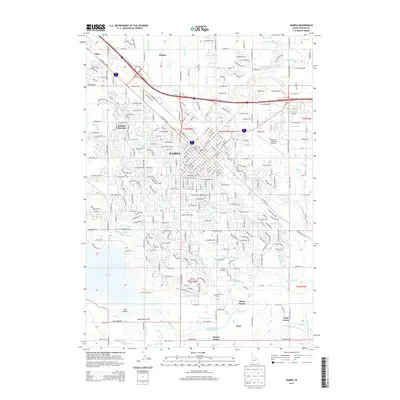
2013 Map of Nampa
USGS Topo · Published 2013About this map
Nampa serves as the central hub of this Idaho landscape, where an intricate network of irrigation channels and drainage ditches defines the agricultural and suburban layout. The map reveals the critical role of water management in the region, with the Phyllis Canal, Ridenbaugh Canal, and Wilson Drain crisscrossing the terrain. Industrial and institutional footprints are prominent, including the Northwest Nazarene Univ campus and the legacy of the Sugar Factory Camp. Beyond the city center, the survey details several historically named crossroads and small settlements such as Karcher Junction, Tiegs Corner, and Fischer. To the south, the terrain transitions toward the water at Upper Deer Flat, while the Nampa Municipal Airport and Nampa Hatchery indicate the specialized land use essential to the county's infrastructure in the early 21st century.
Find a feature on this map
150 named features on this map. Tap any name to fly to it.
Don’t see what you’re looking for? This feature index may not catch every label — zoom into the map to look around manually.
Map Details
Editions of this 2013 Nampa Map
This is the sole edition of this map. No revisions or reprints were ever made.
Other maps of this area

1892 · Boise
USGS Topo · 1:125,000

1892 · Bisuka
USGS Topo · 1:125,000

1892 · Silver City
USGS Topo · 1:125,000

1894 · Bisuka
USGS Topo · 1:125,000

1894 · Silver City
USGS Topo · 1:125,000

1897 · Boise
USGS Topo · 1:125,000

1898 · Nampa
USGS Topo · 1:125,000

1898 · Silver City
USGS Topo · 1:125,000

1953 · Meridian
USGS Topo · 1:24,000

1953 · Star
USGS Topo · 1:24,000