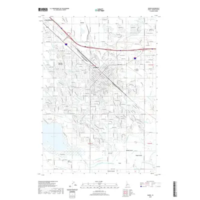
2020 Map of Nampa
USGS Topo · Published 2020About this map
Nampa serves as a dense hub of infrastructure and education in the Treasure Valley, anchored by institutions like Northwest Nazarene University and the College of Western Idaho. The landscape is a complex grid of residential expansion and agricultural water management, defined by an intricate network of irrigation systems including the Phyllis Canal, New York Canal, and numerous laterals like the Thacker Lateral and Stone Lateral. These waterways, alongside drains such as Wilson Drain, illustrate the long-standing engineering required to sustain this arid region's growth.
Find a feature on this map
227 named features on this map. Tap any name to fly to it.
Don’t see what you’re looking for? This feature index may not catch every label — zoom into the map to look around manually.
Map Details
Editions of this 2020 Nampa Map
This is the sole edition of this map. No revisions or reprints were ever made.
Other maps of this area

1892 · Boise
USGS Topo · 1:125,000

1892 · Bisuka
USGS Topo · 1:125,000

1892 · Silver City
USGS Topo · 1:125,000

1894 · Bisuka
USGS Topo · 1:125,000

1894 · Silver City
USGS Topo · 1:125,000

1897 · Boise
USGS Topo · 1:125,000

1898 · Nampa
USGS Topo · 1:125,000

1898 · Silver City
USGS Topo · 1:125,000

1953 · Meridian
USGS Topo · 1:24,000

1953 · Star
USGS Topo · 1:24,000