2024 Map of Nampa
USGS Topo · Published 2024About this map
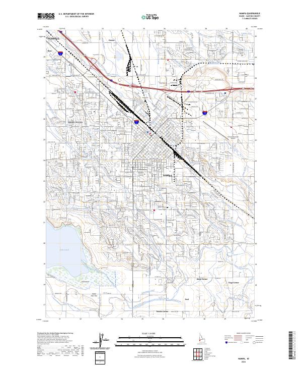
Nampa and the surrounding Treasure Valley landscape are defined by an intricate network of irrigation systems and early 21st-century growth. The map detail highlights the reliance on water infrastructure, including the Phyllis Canal, Ridenbaugh Canal, and Mason Creek, which transformed this arid region into a productive agricultural and residential hub. The presence of Northwest Nazarene University anchors the city's historic core, while industrial and transportation corridors follow the E Railroad St and Interstate 84.
Find a feature on this map
113 named features on this map. Tap any name to fly to it.
Don’t see what you’re looking for? This feature index may not catch every label — zoom into the map to look around manually.
Map Details
Editions of this 2024 Nampa Map
This is the sole edition of this map. No revisions or reprints were ever made.