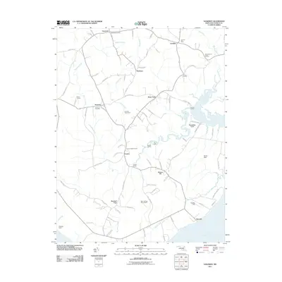
2011 Map of Nanjemoy
USGS Topo · Published 2011About this map
Potomac River frontage and the low-lying wetlands of southwestern Charles County define this landscape at the start of the 2010s. The region is marked by small settlements such as Nanjemoy, Ironsides, and Grayton, connected by a network of rural roads that often bear family names, suggesting a deep local history. Waterways like Beaverdam Creek and Hancock Run wind through the interior, while the shoreline is dotted with small aviation and maritime points, including Parks Airpark and Burgess Landing.
Find a feature on this map
83 named features on this map. Tap any name to fly to it.
Don’t see what you’re looking for? This feature index may not catch every label — zoom into the map to look around manually.
Map Details
Editions of this 2011 Nanjemoy Map
This is the sole edition of this map. No revisions or reprints were ever made.
Other maps of this area

1889 · Fredericksburg
USGS Topo · 1:125,000

1890 · Mt. Vernon
USGS Topo · 1:125,000

1891 · Mt. Vernon
USGS Topo · 1:125,000

1892 · Fredericksburg
USGS Topo · 1:125,000

1894 · Fredericksburg
USGS Topo · 1:125,000

1894 · Mt. Vernon
USGS Topo · 1:125,000

1897 · Mt. Vernon
USGS Topo · 1:125,000

1913 · Indian Head
USGS Topo · 1:62,500

1913 · Nanjemoy
USGS Topo · 1:62,500

1923 · Indian Head
USGS Topo · 1:48,000