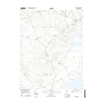
2014 Map of Nanjemoy
USGS Topo · Published 2014About this map
Nanjemoy Creek carves a deep path through the southern reaches of Charles County, defining a landscape of low-lying peninsulas like Tayloe Neck and Maryland Point. This area of the Maryland shore maintains a traditional settlement pattern, with small communities such as Ironsides, Doncaster, and Grayton linked by historical routes like Port Tobacco Rd. The coastal topography is punctuated by several small airstrips, including Washington Field Airport and Burgess Field Airport, reflecting the region's relationship with both the water and the sky.
Find a feature on this map
65 named features on this map. Tap any name to fly to it.
Don’t see what you’re looking for? This feature index may not catch every label — zoom into the map to look around manually.
Map Details
Editions of this 2014 Nanjemoy Map
This is the sole edition of this map. No revisions or reprints were ever made.
Other maps of this area

1889 · Fredericksburg
USGS Topo · 1:125,000

1890 · Mt. Vernon
USGS Topo · 1:125,000

1891 · Mt. Vernon
USGS Topo · 1:125,000

1892 · Fredericksburg
USGS Topo · 1:125,000

1894 · Fredericksburg
USGS Topo · 1:125,000

1894 · Mt. Vernon
USGS Topo · 1:125,000

1897 · Mt. Vernon
USGS Topo · 1:125,000

1913 · Indian Head
USGS Topo · 1:62,500

1913 · Nanjemoy
USGS Topo · 1:62,500

1923 · Indian Head
USGS Topo · 1:48,000