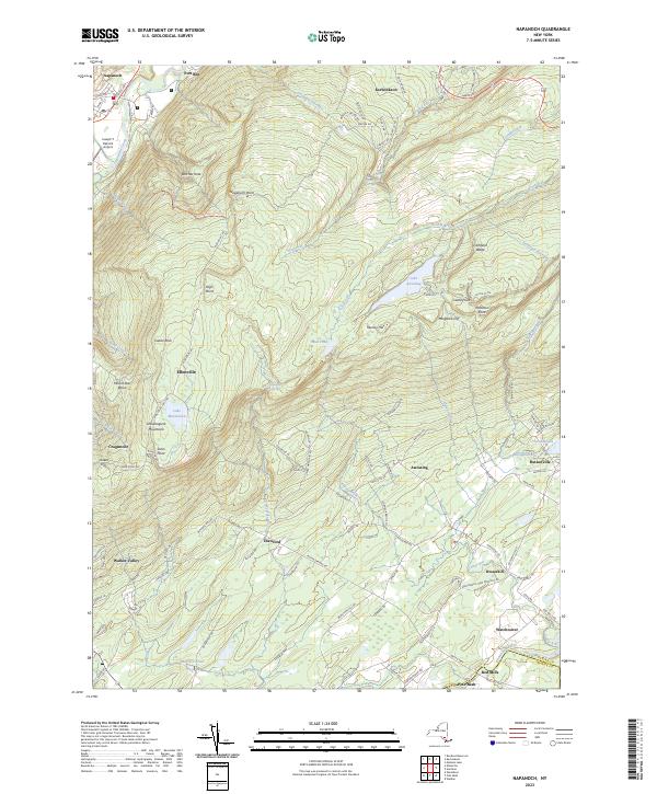
2023 Map of Napanoch
USGS Topo · Published 2023About this map
The Shawangunk Mountains dominate this landscape, rising sharply between the Rondout Creek valley and the rolling terrain to the southeast. The area centers on the town of Napanoch and the village of Ellenville, where local infrastructure like the Joseph Y Resnick Airport meets the older corridors of Plank Rd and Old Rte 209. A complex network of water management is visible via the Delaware Aqueduct, which cuts across the northern terrain near Kerhonkson.
Find a feature on this map
109 named features on this map. Tap any name to fly to it.
Don’t see what you’re looking for? This feature index may not catch every label — zoom into the map to look around manually.
Map Details
Editions of this 2023 Napanoch Map
This is the sole edition of this map. No revisions or reprints were ever made.
Other maps of this area

1901 · Rosendale
USGS Topo · 1:62,500

1903 · Newburg
USGS Topo · 1:62,500

1903 · Rosendale
USGS Topo · 1:62,500

1903 · Slide Mountain
USGS Topo · 1:62,500

1904 · Ellenville
USGS Topo · 1:62,500

1905 · Slide Mountain
USGS Topo · 1:62,500

1906 · Ellenville
USGS Topo · 1:62,500
1942 · Walden
USGS Topo · 1:24,000

1942 · Lackawack
USGS Topo · 1:24,000

1942 · Kerhonkson
USGS Topo · 1:24,000