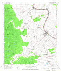
1965 Map of Napoleonville
USGS Topo · Published 1967About this map
Bayou Lafourche dictates the settlement pattern of Assumption Parish in the mid-1960s, with a dense ribbon of development following its winding course. The town of Napoleonville serves as the focal point, connected to outlying communities like Paincourtville and Plattenville by the Texas and Pacific and Southern Pacific railroads. The map illustrates the transition from a traditional river-based agricultural economy to industrial diversification. To the west, the massive East Lake Verret Gas and Oil Field occupies the wetlands, while plantation-era names like Elm Hall, Glenwood, and Westfield persist as modern settlements and rail junctions. Cultural landmarks including Mt Pilgrim Ch, St Benedict Sch, and Evening Star Cem provide essential data for local historians and genealogists tracing the community's mid-century footprint.
Find a feature on this map
37 named features on this map. Tap any name to fly to it.
Don’t see what you’re looking for? This feature index may not catch every label — zoom into the map to look around manually.
Map Details
Editions of this 1965 Napoleonville Map
Other maps of this area

1892 · Donaldsonville
USGS Topo · 1:62,500

1892 · Thibodaux
USGS Topo · 1:62,500

1927 · Thibodaux NW
USGS Topo · 1:31,680

1932 · Thibodaux SW
USGS Topo · 1:31,680

1936 · White Castle
USGS Topo · 1:62,500

1938 · Labadieville
USGS Topo · 1:24,000

1939 · Donaldsonville
USGS Topo · 1:62,500

1940 · Madewood
USGS Topo · 1:31,680

1945 · New Orleans
USGS Topo · 1:250,000

1947 · Donaldsonville
USGS Topo · 1:31,680