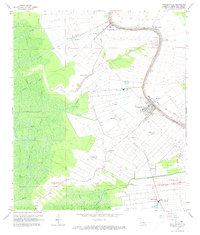
1965 Map of Napoleonville
USGS Topo · Published 1973About this map
Bayou Lafourche meanders through this portion of Assumption Parish, serving as the historical and geographical spine for settlements like Paincourtville, Plattenville, and the parish seat of Napoleonville. The landscape reveals a classic Louisiana long-lot pattern, where narrow tracts of land extend away from the bayou’s natural levees toward the backswamps. Transportation is defined by the parallel routes of the Texas and Pacific and Southern Pacific railroads, which facilitated the region's sugar and agricultural economy.
Find a feature on this map
38 named features on this map. Tap any name to fly to it.
Don’t see what you’re looking for? This feature index may not catch every label — zoom into the map to look around manually.
Map Details
Editions of this 1965 Napoleonville Map
Other maps of this area

1892 · Donaldsonville
USGS Topo · 1:62,500

1892 · Thibodaux
USGS Topo · 1:62,500

1927 · Thibodaux NW
USGS Topo · 1:31,680

1932 · Thibodaux SW
USGS Topo · 1:31,680

1936 · White Castle
USGS Topo · 1:62,500

1938 · Labadieville
USGS Topo · 1:24,000

1939 · Donaldsonville
USGS Topo · 1:62,500

1940 · Madewood
USGS Topo · 1:31,680

1945 · New Orleans
USGS Topo · 1:250,000

1947 · Donaldsonville
USGS Topo · 1:31,680