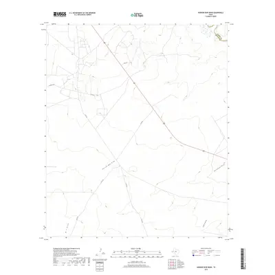
2019 Map of Narrow Bow Draw
USGS Topo · Published 2019About this map
The Pecos River carves through the northeastern corner of this West Texas landscape, marking the natural boundary between Loving Co and Reeves Co. This arid stretch of the Permian Basin is defined by its drainage networks, where seasonal watercourses like Narrow Bow Draw and Horsehead Draw channel runoff across the wide plains. The terrain is largely open and industrial-rural, crisscrossed by a grid of county roads such as Co Rd 433 and Co Rd 432 that service the region's energy and ranching operations.
Find a feature on this map
12 named features on this map. Tap any name to fly to it.
Don’t see what you’re looking for? This feature index may not catch every label — zoom into the map to look around manually.
Map Details
Editions of this 2019 Narrow Bow Draw Map
This is the sole edition of this map. No revisions or reprints were ever made.
Other maps of this area

1931 · Orla
USGS Topo · 1:62,500

1954 · Pecos
USGS Topo · 1:250,000

1957 · Pecos
USGS Topo · 1:250,000

1961 · Anderson Ranch
USGS Topo · 1:24,000

1961 · Orla SE
USGS Topo · 1:24,000

1961 · Lindley Ranch
USGS Topo · 1:24,000

1961 · Narrow Bow Draw
USGS Topo · 1:24,000

1968 · Threemile Draw
USGS Topo · 1:24,000

1968 · Orla
USGS Topo · 1:24,000

1968 · W T Ranch
USGS Topo · 1:24,000