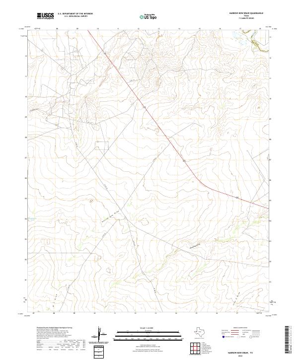
2022 Map of Narrow Bow Draw
USGS Topo · Published 2022About this map
Narrow Bow Draw and the surrounding arid landscape of West Texas define this topographic study along the boundary of Loving Co and Reeves Co. The Pecos River makes a brief appearance in the northeast corner, a critical water source in a region otherwise dominated by seasonal drainage features like Horsehead Draw and Fourmile Draw. The terrain is marked by gradual elevation changes and the sparse infrastructure of the Permian Basin, where highway 285 cuts a diagonal path through the brushland. Local water management is represented by Hackberry Tank, while a network of county roads including Co RD 433 and Co RD 432 provides access to this isolated portion of the Chihuahuan Desert, serving as primary reference points for land navigation and ranching interests.
Find a feature on this map
13 named features on this map. Tap any name to fly to it.
Don’t see what you’re looking for? This feature index may not catch every label — zoom into the map to look around manually.
Map Details
Editions of this 2022 Narrow Bow Draw Map
This is the sole edition of this map. No revisions or reprints were ever made.
Other maps of this area

1931 · Orla
USGS Topo · 1:62,500

1954 · Pecos
USGS Topo · 1:250,000

1957 · Pecos
USGS Topo · 1:250,000

1961 · Anderson Ranch
USGS Topo · 1:24,000

1961 · Orla SE
USGS Topo · 1:24,000

1961 · Lindley Ranch
USGS Topo · 1:24,000

1961 · Narrow Bow Draw
USGS Topo · 1:24,000

1968 · Threemile Draw
USGS Topo · 1:24,000

1968 · Orla
USGS Topo · 1:24,000

1968 · W T Ranch
USGS Topo · 1:24,000