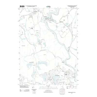
2013 Map of Narrowsburg
USGS Topo · Published 2013About this map
The Delaware River forms a winding natural border between New York and Pennsylvania, anchoring the development of riverside settlements like Narrowsburg and Tusten. In this 2013 landscape, the terrain is defined by a series of significant water bodies, including Welcome Lake, Wolf Lake, and the expansive Teedyuskung Lake, which emphasize the region's character as a hub for recreation and summer camps. The presence of Camp Solang and the Masthope Ski Area highlights the area's transition toward leisure and seasonal residency.
Find a feature on this map
73 named features on this map. Tap any name to fly to it.
Don’t see what you’re looking for? This feature index may not catch every label — zoom into the map to look around manually.
Map Details
Editions of this 2013 Narrowsburg Map
This is the sole edition of this map. No revisions or reprints were ever made.
Other maps of this area

1913 · Milford
USGS Topo · 1:62,500

1915 · Milford
USGS Topo · 1:62,500

1920 · Damascus
USGS Topo · 1:62,500

1922 · White Lake
USGS Topo · 1:62,500

1923 · Damascus
USGS Topo · 1:62,500

1935 · Hawley
USGS Topo · 1:62,500

1938 · Hawley
USGS Topo · 1:62,500

1942 · White Lake
USGS Topo · 1:62,500

1943 · Honesdale
USGS Topo · 1:125,000

1943 · White Lake
USGS Topo · 1:62,500
Featured Places
- Lackawaxen Township, PA
- Damascus Township, PA
- Tusten, NY
- Narrowsburg, Tusten
- Westcolang, Lackawaxen Township