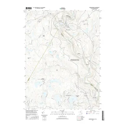
2016 Map of Narrowsburg
USGS Topo · Published 2016About this map
The Delaware River cuts through this borderland between Pennsylvania and New York, carving the dramatic Delaware River Gorge as it passes through the Upper Delaware Scenic and Recreational River corridor. On the New York side, the hamlet of Narrowsburg serves as a primary crossing point, with its residential streets climbing toward Darbytown. To the south in Pennsylvania, the landscape is defined by recreation and private communities, including Fawn Lake Forest and Westcolang Park, situated among a dense network of water bodies like Teedyuskung Lake and Corilla Lake.
Find a feature on this map
142 named features on this map. Tap any name to fly to it.
Don’t see what you’re looking for? This feature index may not catch every label — zoom into the map to look around manually.
Map Details
Editions of this 2016 Narrowsburg Map
This is the sole edition of this map. No revisions or reprints were ever made.
Other maps of this area

1913 · Milford
USGS Topo · 1:62,500

1915 · Milford
USGS Topo · 1:62,500

1920 · Damascus
USGS Topo · 1:62,500

1922 · White Lake
USGS Topo · 1:62,500

1923 · Damascus
USGS Topo · 1:62,500

1935 · Hawley
USGS Topo · 1:62,500

1938 · Hawley
USGS Topo · 1:62,500

1942 · White Lake
USGS Topo · 1:62,500

1943 · Honesdale
USGS Topo · 1:125,000

1943 · White Lake
USGS Topo · 1:62,500
Featured Places
- Lackawaxen Township, PA
- Damascus Township, PA
- Tusten, NY
- Narrowsburg, Tusten
- Westcolang, Lackawaxen Township