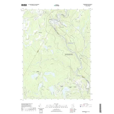
2019 Map of Narrowsburg
USGS Topo · Published 2019About this map
The Delaware River cuts through this borderland where Pennsylvania’s Pike and Wayne Counties meet Sullivan County, New York. The river corridor is defined here by the Delaware River Gorge and the federally protected Upper Delaware Scenic and Recreational River, a landscape of steep elevation changes and dense hydrology. Upland from the river, small settlements and residential pockets such as Narrowsburg, Darbytown, and Masthope are connected by historical routes like the Hansdale and Delaware Tpke. The map shows a transition from traditional riverside hamlets to modern planned communities like Fawn Lake Forest and Westcolang Park. Numerous small water bodies, including Welcome Lake, Wolf Lake, and Feagles Lake, dot the interior, often surrounded by established cemeteries like Saint Francis Xavier Cem and Lava Cem that serve as anchor points for local genealogy.
Find a feature on this map
157 named features on this map. Tap any name to fly to it.
Don’t see what you’re looking for? This feature index may not catch every label — zoom into the map to look around manually.
Map Details
Editions of this 2019 Narrowsburg Map
This is the sole edition of this map. No revisions or reprints were ever made.
Other maps of this area

1913 · Milford
USGS Topo · 1:62,500

1915 · Milford
USGS Topo · 1:62,500

1920 · Damascus
USGS Topo · 1:62,500

1922 · White Lake
USGS Topo · 1:62,500

1923 · Damascus
USGS Topo · 1:62,500

1935 · Hawley
USGS Topo · 1:62,500

1938 · Hawley
USGS Topo · 1:62,500

1942 · White Lake
USGS Topo · 1:62,500

1943 · Honesdale
USGS Topo · 1:125,000

1943 · White Lake
USGS Topo · 1:62,500
Featured Places
- Lackawaxen Township, PA
- Damascus Township, PA
- Tusten, NY
- Narrowsburg, Tusten
- Westcolang, Lackawaxen Township