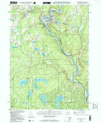
1997 Map of Narrowsburg
USGS Topo · Published 1999About this map
The Delaware River winds through the heart of this borderland region, defining the boundary between Pennsylvania and New York. The community of Narrowsburg serves as a central hub along the riverbanks, where the Erie railroad line tracks the water's edge through Tusten and past Tusten Station. The landscape is dominated by high ridges like Point Peter and Rattlesnake Ridge, interspersed with numerous glacial water bodies such as Teedyuskung Lake, Wolf Lake, and the expansive Panther Lake.
Find a feature on this map
61 named features on this map. Tap any name to fly to it.
Don’t see what you’re looking for? This feature index may not catch every label — zoom into the map to look around manually.
Map Details
Editions of this 1997 Narrowsburg Map
2 editions found
Other maps of this area

1913 · Milford
USGS Topo · 1:62,500

1915 · Milford
USGS Topo · 1:62,500

1920 · Damascus
USGS Topo · 1:62,500

1922 · White Lake
USGS Topo · 1:62,500

1923 · Damascus
USGS Topo · 1:62,500

1935 · Hawley
USGS Topo · 1:62,500

1938 · Hawley
USGS Topo · 1:62,500

1942 · White Lake
USGS Topo · 1:62,500

1943 · Honesdale
USGS Topo · 1:125,000

1943 · White Lake
USGS Topo · 1:62,500