2023 Map of Naschitti
USGS Topo · Published 2023About this map
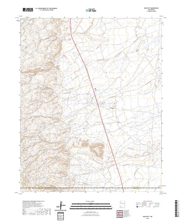
Naschitti serves as the primary settlement hub on this high-desert plateau, positioned along a transportation corridor that bridges the San Juan and McKinley County line. The landscape is defined by the ephemeral drainage of the Naschitti Wash and the Salt Springs Wash, which carve through the arid terrain. The mapping reveals a detailed network of infrastructure supporting the community, including the centrally located Naschitti Cem and numerous Bureau of Indian Affairs routes such as Indian Svc Rte 69 and Indian Svc Rte 693.
Find a feature on this map
21 named features on this map. Tap any name to fly to it.
Don’t see what you’re looking for? This feature index may not catch every label — zoom into the map to look around manually.
Map Details
Editions of this 2023 Naschitti Map
This is the sole edition of this map. No revisions or reprints were ever made.
Historical Maps of Naschitti Through Time
Featured Locations
- Fort Defiance Agency
- Shiprock Agency
- McKinley County, NM
- San Juan County, NM
- Naschitti, Fort Defiance Agency