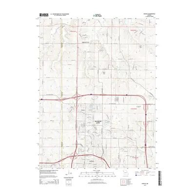
2014 Map of Nashua
USGS Topo · Published 2014About this map
Smithville and the northern suburban expansion of Kansas City define this transition between developed neighborhoods and the rural landscape of Clay and Platte Counties. The terrain is deeply etched by the branching headwaters of Shoal Creek and the East Fork Shoal Creek, creating a complex network of ridges and valleys that direct the residential street grids. Smaller communities like Nashua and Gashland appear as established nodes within the growing metropolitan footprint, while sites such as Resurrection Cemetery and Brooks Cemetery provide points of reference for local family history. Private aviation is represented by the Rollert Farm Airport and Dunham Private Airport, highlighting the area's mixed-use character. The map also captures numerous local water bodies, including Bell Lake, Sampson Lake, and Stevens Lake, which punctuate the drainage basins of First Creek and Second Creek.
Find a feature on this map
138 named features on this map. Tap any name to fly to it.
Don’t see what you’re looking for? This feature index may not catch every label — zoom into the map to look around manually.
Map Details
Editions of this 2014 Nashua Map
This is the sole edition of this map. No revisions or reprints were ever made.
Other maps of this area

1890 · Kansas City
USGS Topo · 1:125,000

1894 · Kansas City
USGS Topo · 1:125,000

1894 · Independence
USGS Topo · 1:125,000

1914 · Smithville
USGS Topo · 1:62,500

1935 · North Kansas City
USGS Topo · 1:24,000

1935 · Liberty
USGS Topo · 1:24,000

1936 · Kearney
USGS Topo · 1:48,000

1940 · Liberty
USGS Topo · 1:31,680
1940 · North Kansas City
USGS Topo · 1:31,680

1942 · Kearney
USGS Topo · 1:62,500