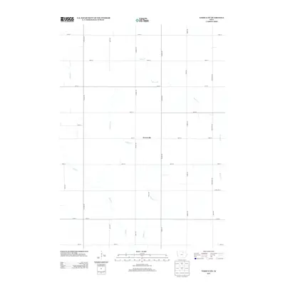
2013 Map of Nashua NW
USGS Topo · Published 2013About this map
Powersville sits at the heart of this rural landscape in Floyd County, marking a localized cluster of settlement amidst an extensive grid of section-line roads. The terrain is defined by the winding paths of several waterways, including Beaver Cr and Schuyler Cr, which carve through the agricultural fields that dominate the region. The road network, organized by a strict numeric and alphabetical system including 290th St and Rampart Ave, reflects the systematic land partitioning common in the Iowa countryside. This area shows a pattern of scattered homesteads and farming operations, with drainage provided by Flood Cr and Peters Cr. The map illustrates the persistent structure of midwestern rural life in the early 21st century, where the relationship between family farms and the drainage basins of small creeks remains the primary geographical framework.
Find a feature on this map
27 named features on this map. Tap any name to fly to it.
Don’t see what you’re looking for? This feature index may not catch every label — zoom into the map to look around manually.
Map Details
Editions of this 2013 Nashua NW Map
This is the sole edition of this map. No revisions or reprints were ever made.
Other maps of this area

1954 · Mason City
USGS Topo · 1:250,000

1954 · Waterloo
USGS Topo · 1:250,000

1955 · Waterloo
USGS Topo · 1:250,000

1957 · Mason City
USGS Topo · 1:250,000

1958 · Mason City
USGS Topo · 1:250,000

1971 · Plainfield
USGS Topo · 1:24,000

1971 · Charles City
USGS Topo · 1:24,000

1971 · Nashua NW
USGS Topo · 1:24,000

1971 · Clarksville
USGS Topo · 1:24,000

1971 · Bassett
USGS Topo · 1:24,000