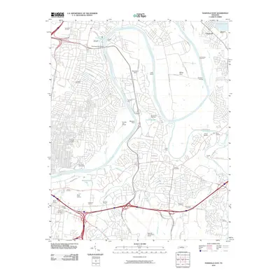
2010 Map of Nashville East
USGS Topo · Published 2010About this map
The Cumberland River carves a sweeping path through this landscape, defining the character of the riverfront near Lakewood and the southern reaches of Old Hickory Lake. Significant river crossings and historic landings are well-documented, including the Old Donelson Horse Ford, Woodyard Landing, and Hocketts Ford, illustrating the area's long-standing connection to water-based transport. Large tracts of land are dedicated to major municipal and social infrastructure, such as the Nashville International Airport and the Cornelia Fort Airpark. This geography also contains a concentration of significant historic burial grounds, including the expansive Mount Olivet Cemetery, Calvary Cemetery, and Greenwood Cemetery. These sites, alongside landmarks like Clover Bottom and the Home of the Aged, provide a detailed record of the community's development as it grew outward from the core of East Nashville.
Find a feature on this map
80 named features on this map. Tap any name to fly to it.
Don’t see what you’re looking for? This feature index may not catch every label — zoom into the map to look around manually.
Map Details
Editions of this 2010 Nashville East Map
This is the sole edition of this map. No revisions or reprints were ever made.
Other maps of this area

1903 · Nashville
USGS Topo · 1:125,000

1931 · Ridgetop
USGS Topo · 1:62,500

1932 · Hermitage
USGS Topo · 1:62,500

1932 · Nashville
USGS Topo · 1:62,500

1935 · Ridgetop
USGS Topo · 1:62,500

1942 · Gallatin
USGS Topo · 1:100,000

1942 · Lebanon
USGS Topo · 1:100,000

1952 · Goodlettsville
USGS Topo · 1:24,000

1952 · Hendersonville
USGS Topo · 1:24,000

1952 · Hermitage
USGS Topo · 1:24,000