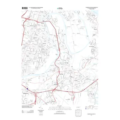
2013 Map of Nashville East
USGS Topo · Published 2013About this map
The Cumberland River carves a winding path through this eastern portion of Nashville, defining the geography of established neighborhoods like Inglewood, Donelson, and Dalewood. The map illustrates the region's complex water network, where the Stones River joins the main channel near the historical Old Donelson Horse Ford and Clover Bottom. This landscape is a mix of suburban development and significant transit infrastructure, anchored in the south by the extensive grounds of the Nashville International Airport and the northern reaches of the J Percy Priest Reservoir.
Find a feature on this map
48 named features on this map. Tap any name to fly to it.
Don’t see what you’re looking for? This feature index may not catch every label — zoom into the map to look around manually.
Map Details
Editions of this 2013 Nashville East Map
This is the sole edition of this map. No revisions or reprints were ever made.
Other maps of this area

1903 · Nashville
USGS Topo · 1:125,000

1931 · Ridgetop
USGS Topo · 1:62,500

1932 · Hermitage
USGS Topo · 1:62,500

1932 · Nashville
USGS Topo · 1:62,500

1935 · Ridgetop
USGS Topo · 1:62,500

1942 · Gallatin
USGS Topo · 1:100,000

1942 · Lebanon
USGS Topo · 1:100,000

1952 · Goodlettsville
USGS Topo · 1:24,000

1952 · Hendersonville
USGS Topo · 1:24,000

1952 · Hermitage
USGS Topo · 1:24,000