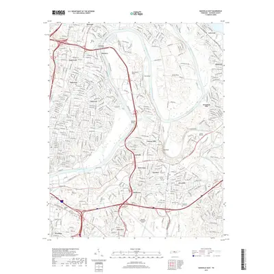
2019 Map of Nashville East
USGS Topo · Published 2019About this map
The Cumberland River carves a winding path through the heart of this East Nashville landscape, defining the deep oxbow of Neelys Bend and the peninsula of Pennington Bend. This 2019 survey documents a densely layered suburban and industrial corridor where modern transit hubs like the Nashville International Airport sit alongside significant historical sites. The area is particularly notable for its concentration of large memorial grounds, including the expansive Spring Hill Cem, Mount Olivet Cem, and Calvary Cem, providing a detailed record for genealogical research. Residential expansion is evident across established neighborhoods such as Inglewood, Donelson, and Dalewood. South of the Stones River confluence, smaller family landmarks like the John Buchanan Cem and Bryantown Family Cem remain preserved among the modern developments of Cloverhill and Mudtavern, tracing the early settlement patterns of Davidson County.
Find a feature on this map
50 named features on this map. Tap any name to fly to it.
Don’t see what you’re looking for? This feature index may not catch every label — zoom into the map to look around manually.
Map Details
Editions of this 2019 Nashville East Map
This is the sole edition of this map. No revisions or reprints were ever made.
Other maps of this area

1903 · Nashville
USGS Topo · 1:125,000

1931 · Ridgetop
USGS Topo · 1:62,500

1932 · Hermitage
USGS Topo · 1:62,500

1932 · Nashville
USGS Topo · 1:62,500

1935 · Ridgetop
USGS Topo · 1:62,500

1942 · Gallatin
USGS Topo · 1:100,000

1942 · Lebanon
USGS Topo · 1:100,000

1952 · Goodlettsville
USGS Topo · 1:24,000

1952 · Hendersonville
USGS Topo · 1:24,000

1952 · Hermitage
USGS Topo · 1:24,000