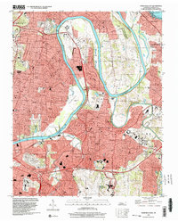
1997 Map of Nashville East
USGS Topo · Published 2002About this map
The Cumberland River carves a winding path through this eastern segment of Nashville, defining a landscape of suburban expansion and infrastructure. In the north, Old Hickory Lake dominates the shoreline near Lakewood, while the sprawling Nashville International Airport occupies the southern reaches. This late-century layout shows the dense residential grids of Inglewood and Donelson contrasted with the expansive green spaces of Spring Hill Cemetery and Mount Olivet Cemetery.
Find a feature on this map
63 named features on this map. Tap any name to fly to it.
Don’t see what you’re looking for? This feature index may not catch every label — zoom into the map to look around manually.
Map Details
Editions of this 1997 Nashville East Map
This is the sole edition of this map. No revisions or reprints were ever made.
Other maps of this area

1903 · Nashville
USGS Topo · 1:125,000

1931 · Ridgetop
USGS Topo · 1:62,500

1932 · Hermitage
USGS Topo · 1:62,500

1932 · Nashville
USGS Topo · 1:62,500

1935 · Ridgetop
USGS Topo · 1:62,500

1942 · Gallatin
USGS Topo · 1:100,000

1942 · Lebanon
USGS Topo · 1:100,000

1952 · Goodlettsville
USGS Topo · 1:24,000

1952 · Hendersonville
USGS Topo · 1:24,000

1952 · Hermitage
USGS Topo · 1:24,000