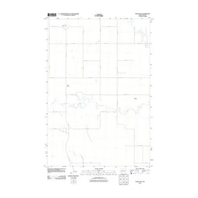
2011 Map of Nason Hill
USGS Topo · Published 2011About this map
Nason Hill rises above the prairie landscape of Adams County, overlooking a network of section-line roads and seasonal waterways. This 2011 survey captures the rural character of the North Dakota badlands fringe, where the meandering course of Cedar Creek serves as a primary geographical anchor. The map provides significant detail for genealogical research, identifying the locations of Cedar Creek Cemetery and Stowers Cemetery, which stand as markers of early settlement history in this sparsely populated region. The drainage patterns of Plum Creek and Timber Creek reveal the natural topography that shaped the placement of farmsteads and the grid of local routes like 9th Ave NE and 27th St NE. The systematic arrangement of roads and lack of dense development reflect the enduring agrarian nature of the Plains at the start of the 21st century.
Find a feature on this map
21 named features on this map. Tap any name to fly to it.
Don’t see what you’re looking for? This feature index may not catch every label — zoom into the map to look around manually.
Map Details
Editions of this 2011 Nason Hill Map
This is the sole edition of this map. No revisions or reprints were ever made.
Other maps of this area

1953 · McIntosh
USGS Topo · 1:250,000

1953 · Dickinson
USGS Topo · 1:250,000

1954 · Lemmon
USGS Topo · 1:250,000

1954 · Bismarck
USGS Topo · 1:250,000

1957 · Dickinson
USGS Topo · 1:250,000

1957 · Lemmon
USGS Topo · 1:250,000

1958 · Bismarck
USGS Topo · 1:250,000

1958 · McIntosh
USGS Topo · 1:250,000

1972 · Coffin Buttes
USGS Topo · 1:24,000

1972 · Round Top
USGS Topo · 1:24,000