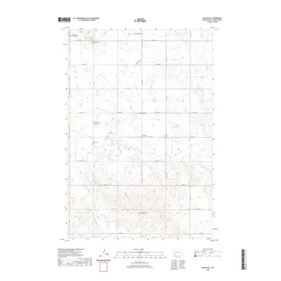
2020 Map of Nason Hill
USGS Topo · Published 2020About this map
Nason Hill rises above a quiet prairie landscape in Adams County, marked by a sparse grid of section roads and small watercourses like Timber Cr and Blum Cr. The area’s history is anchored by its remote cemeteries, including the Prince of Peace Cem - Cedar Creek Cem and the Holy Family Catholic Cem. These small, localized burial grounds, along with Stowers Cem, suggest the distribution of early homesteading families and parish communities across this portion of the North Dakota plains. The drainage of Cedar Creek winds through the central sections, defining the low-lying terrain between the gravel roads that maintain the region's rectilinear connectivity, such as Black B Blue Rd and various numbered avenues.
Find a feature on this map
31 named features on this map. Tap any name to fly to it.
Don’t see what you’re looking for? This feature index may not catch every label — zoom into the map to look around manually.
Map Details
Editions of this 2020 Nason Hill Map
This is the sole edition of this map. No revisions or reprints were ever made.
Other maps of this area

1953 · McIntosh
USGS Topo · 1:250,000

1953 · Dickinson
USGS Topo · 1:250,000

1954 · Lemmon
USGS Topo · 1:250,000

1954 · Bismarck
USGS Topo · 1:250,000

1957 · Dickinson
USGS Topo · 1:250,000

1957 · Lemmon
USGS Topo · 1:250,000

1958 · Bismarck
USGS Topo · 1:250,000

1958 · McIntosh
USGS Topo · 1:250,000

1972 · Coffin Buttes
USGS Topo · 1:24,000

1972 · Round Top
USGS Topo · 1:24,000