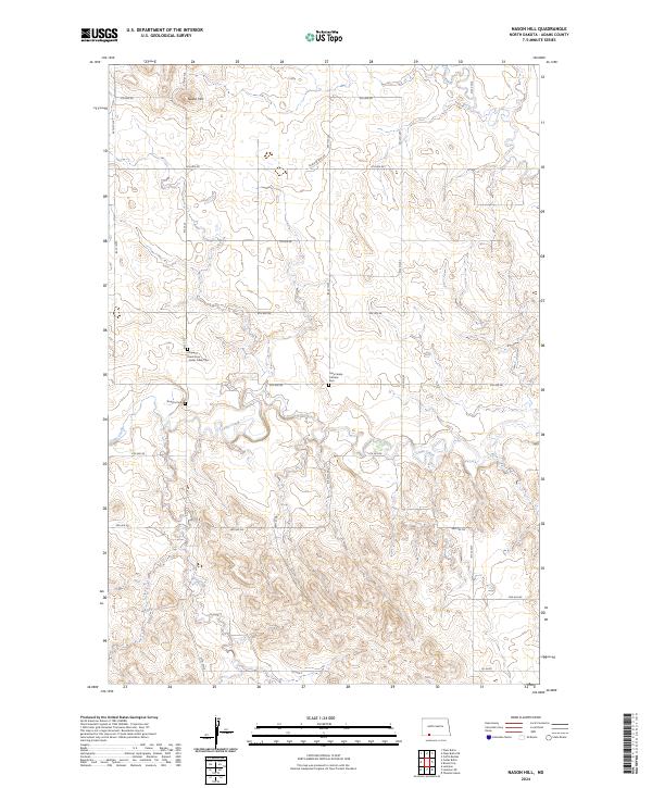
2024 Map of Nason Hill
USGS Topo · Published 2024About this map
Nason Hill rises as a prominent landmark in this corner of Adams County, where the high plains terrain is deeply etched by the drainage of Cedar Creek, Plum Creek, and Timber Creek. This 2024 survey documents a quiet, rural landscape structured by a precise grid of sectional roads like 8th Ave NE and 27th St NE. The cultural geography is defined by its small community landmarks, particularly the cemeteries that mark family and denominational roots in the region. Prince of Peace Cem - Cedar Creek Cem and the Holy Family Catholic Cem serve as focal points for local history, while Stowers Cem remains situated near the banks of a creek. The presence of Black & Blue Rd among the standard numeric avenues suggests local naming traditions that persist alongside the formal Public Land Survey System boundaries.
Find a feature on this map
27 named features on this map. Tap any name to fly to it.
Don’t see what you’re looking for? This feature index may not catch every label — zoom into the map to look around manually.
Map Details
Editions of this 2024 Nason Hill Map
This is the sole edition of this map. No revisions or reprints were ever made.
Other maps of this area

1953 · McIntosh
USGS Topo · 1:250,000

1953 · Dickinson
USGS Topo · 1:250,000

1954 · Lemmon
USGS Topo · 1:250,000

1954 · Bismarck
USGS Topo · 1:250,000

1957 · Dickinson
USGS Topo · 1:250,000

1957 · Lemmon
USGS Topo · 1:250,000

1958 · Bismarck
USGS Topo · 1:250,000

1958 · McIntosh
USGS Topo · 1:250,000

1972 · Coffin Buttes
USGS Topo · 1:24,000

1972 · Round Top
USGS Topo · 1:24,000