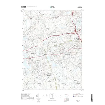
2021 Map of Natick
USGS Topo · Published 2021About this map
Wellesley College, Brandeis University, and Babson College anchor this landscape, illustrating the concentration of academic institutions along the Charles River valley. The mapping identifies deep historical layers, including the ancient Old Connecticut Path and the South Natick Burial Ground, marking the early colonial and Indigenous heritage of the region. The transition of the region's transportation network is evident in the conversion of former rail corridors into the Mass Central/Wayside Rail Trl and Cochituate Rail Trl. Local life is organized around distinct village centers such as Newton Lower Falls, Wellesley Hills, and South Natick. The area is characterized by an abundance of small water bodies like Morses Pond and Lake Waban, which sit alongside numerous hills including Maugus Hill and Broad Hill, defining the suburban character of these established communities.
Find a feature on this map
116 named features on this map. Tap any name to fly to it.
Don’t see what you’re looking for? This feature index may not catch every label — zoom into the map to look around manually.
Map Details
Editions of this 2021 Natick Map
This is the sole edition of this map. No revisions or reprints were ever made.
Other maps of this area

1886 · Dedham
USGS Topo · 1:62,500

1886 · Framingham
USGS Topo · 1:62,500

1887 · Franklin
USGS Topo · 1:62,500

1889 · Franklin
USGS Topo · 1:62,500

1889 · Framingham
USGS Topo · 1:62,500

1893 · Franklin
USGS Topo · 1:62,500

1893 · Boston
USGS Topo · 1:62,500

1894 · Dedham
USGS Topo · 1:62,500

1894 · Framingham
USGS Topo · 1:62,500

1903 · Boston
USGS Topo · 1:62,500