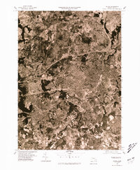
1977 Map of Natick
USGS Topo · Published 1981About this map
The Charles River meanders through the landscape of eastern Massachusetts in this 1977 aerial study, revealing the dense suburban development patterns of the late 1970s. The dense street grids of Natick and Wellesley stand in contrast to the heavily wooded and marshy corridors along the Sudbury River to the west. This orthophotograph captures the region's complex infrastructure during a period of significant growth, where early colonial settlements like Weston and Wayland have transitioned into established commuter hubs.
Find a feature on this map
10 named features on this map. Tap any name to fly to it.
Don’t see what you’re looking for? This feature index may not catch every label — zoom into the map to look around manually.
Map Details
Editions of this 1977 Natick Map
This is the sole edition of this map. No revisions or reprints were ever made.
Other maps of this area

1886 · Dedham
USGS Topo · 1:62,500

1886 · Framingham
USGS Topo · 1:62,500

1887 · Franklin
USGS Topo · 1:62,500

1889 · Franklin
USGS Topo · 1:62,500

1889 · Framingham
USGS Topo · 1:62,500

1893 · Franklin
USGS Topo · 1:62,500

1893 · Boston
USGS Topo · 1:62,500

1894 · Dedham
USGS Topo · 1:62,500

1894 · Framingham
USGS Topo · 1:62,500

1903 · Boston
USGS Topo · 1:62,500