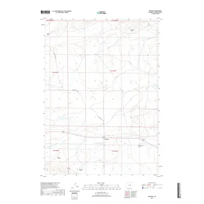
2017 Map of Natrona
USGS Topo · Published 2017About this map
Natrona stands as a focal point in this high-plains landscape, where the town's position is defined by the east-west passage of the highway and the nearby Middle Fork Casper Cr. The surrounding terrain is a complex network of ephemeral drainages and canyons, including Smith Canyon and Baerthel Canyon to the south. Historically significant routes like the Cottonwood Stock Trl wind through the township, reflecting the area's legacy of livestock movement across the basin. To the north, the topography rises toward Wild Horse Lake and is punctuated by numerous draws such as Mikes Draw and Anderson Draw. These features, along with the prominent elevation of Pine Mtn, characterize a region where water sources and topographic breaks dictate the patterns of human settlement and ranching activity.
Find a feature on this map
19 named features on this map. Tap any name to fly to it.
Don’t see what you’re looking for? This feature index may not catch every label — zoom into the map to look around manually.
Map Details
Editions of this 2017 Natrona Map
This is the sole edition of this map. No revisions or reprints were ever made.
Other maps of this area

1951 · Emigrant Gap NW
USGS Topo · 1:24,000

1951 · Square Top Butte
USGS Topo · 1:24,000

1951 · Reid Canyon
USGS Topo · 1:24,000

1955 · Arminto
USGS Topo · 1:250,000

1955 · Casper
USGS Topo · 1:250,000

1958 · Casper
USGS Topo · 1:250,000

1958 · Arminto
USGS Topo · 1:250,000

1962 · Arminto
USGS Topo · 1:250,000

1962 · Casper
USGS Topo · 1:250,000

1968 · Reynolds Reservoir
USGS Topo · 1:24,000