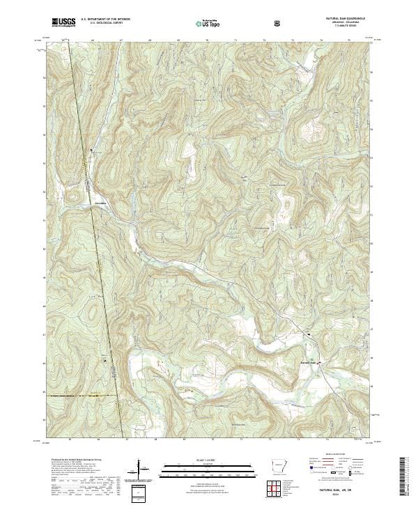
2024 Map of Natural Dam
USGS Topo · Published 2024About this map
The Mountain Fork and Lee Creek wind through the southern Ozark foothills near the Oklahoma-Arkansas border. This survey details the remote topography of the Ozark National Forest, characterized by high points like Chinkapin Knob, Lick Mtn, and Birchfield Mtn. The small settlement of Natural Dam is situated near the confluence of local streams, while the hamlet of Davidson sits further north along the state line. Genealogists can identify several family burial grounds, including Bateman Cem, Morton Cem, and Hall Cem, which are scattered among the hollows. The map also shows a network of local forest routes such as Cove Creek Rd and Liberty Hill Rd that navigate the ridges and gaps of this landscape.
Find a feature on this map
53 named features on this map. Tap any name to fly to it.
Don’t see what you’re looking for? This feature index may not catch every label — zoom into the map to look around manually.
Map Details
Editions of this 2024 Natural Dam Map
This is the sole edition of this map. No revisions or reprints were ever made.
Other maps of this area

1898 · Winslow #3
USGS Topo · 1:62,500

1898 · Tahlequah
USGS Topo · 1:125,000

1898 · Winslow
USGS Topo · 1:125,000

1901 · Winslow
USGS Topo · 1:125,000

1901 · Tahlequah
USGS Topo · 1:125,000

1905 · Tahlequah
USGS Topo · 1:125,000

1946 · Fort Smith
USGS Topo · 1:250,000

1965 · Fort Smith
USGS Topo · 1:250,000

1967 · Fort Smith
USGS Topo · 1:250,000
1969 · Uniontown
USGS Topo · 1:24,000