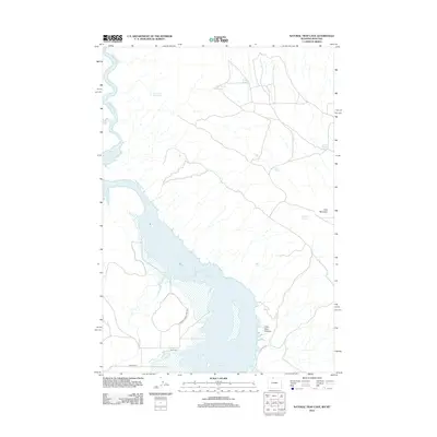
2012 Map of Natural Trap Cave
USGS Topo · Published 2012About this map
Bighorn Lake and the Bighorn River dominate this landscape on the Montana-Wyoming border, where the water has shaped both the natural terrain and human infrastructure. The map reveals a high-desert environment characterized by essential water management, including the Big Fork Canal and several upland catchments like Cedar Buttes Reservoir and Pass Reservoir. These features, along with scattered water sources such as School Section Spring and Georges Spring, illustrate the critical importance of water rights and ranching infrastructure in the region.
Find a feature on this map
14 named features on this map. Tap any name to fly to it.
Don’t see what you’re looking for? This feature index may not catch every label — zoom into the map to look around manually.
Map Details
Editions of this 2012 Natural Trap Cave Map
This is the sole edition of this map. No revisions or reprints were ever made.
Other maps of this area

1954 · Billings
USGS Topo · 1:250,000

1955 · Cody
USGS Topo · 1:250,000

1957 · Billings
USGS Topo · 1:250,000

1958 · Billings
USGS Topo · 1:250,000

1958 · Cody
USGS Topo · 1:250,000

1962 · Cody
USGS Topo · 1:250,000

1964 · Kane
USGS Topo · 1:24,000

1964 · Two Point
USGS Topo · 1:24,000
1964 · Simmons Canyon
USGS Topo · 1:24,000

1964 · Lovell Lakes
USGS Topo · 1:24,000