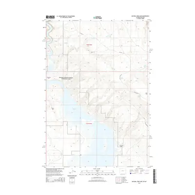
2015 Map of Natural Trap Cave
USGS Topo · Published 2015About this map
Natural Trap Cave and the surrounding high desert terrain define this landscape at the border of Montana and Wyoming. The map shows the significant geological and archaeological landmark alongside the northern reaches of Bighorn Lake, a reservoir created by the damming of the Bighorn River. The topography transitions from the water's edge at Horseshoe Bend to the prominent heights of Sykes Mtn and Little Mtn. This area is preserved within the Bighorn Canyon National Recreation Area, where early industrial and agricultural infrastructure remains visible in the form of the Titan Mine Rd and the Big Horn Canal. Genealogists and local historians can locate the Kane Cem near the southern boundary, a remnant of the community of Kane. Numerous water sources, including School Section Spring and Little Spring, are mapped across the arid canyons and plateaus, marking essential points in this sparsely populated region.
Find a feature on this map
22 named features on this map. Tap any name to fly to it.
Don’t see what you’re looking for? This feature index may not catch every label — zoom into the map to look around manually.
Map Details
Editions of this 2015 Natural Trap Cave Map
This is the sole edition of this map. No revisions or reprints were ever made.
Other maps of this area

1954 · Billings
USGS Topo · 1:250,000

1955 · Cody
USGS Topo · 1:250,000

1957 · Billings
USGS Topo · 1:250,000

1958 · Billings
USGS Topo · 1:250,000

1958 · Cody
USGS Topo · 1:250,000

1962 · Cody
USGS Topo · 1:250,000

1964 · Kane
USGS Topo · 1:24,000

1964 · Two Point
USGS Topo · 1:24,000
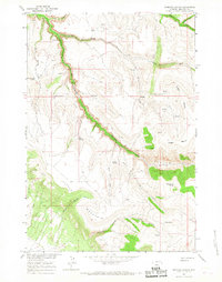
1964 · Simmons Canyon
USGS Topo · 1:24,000

1964 · Lovell Lakes
USGS Topo · 1:24,000