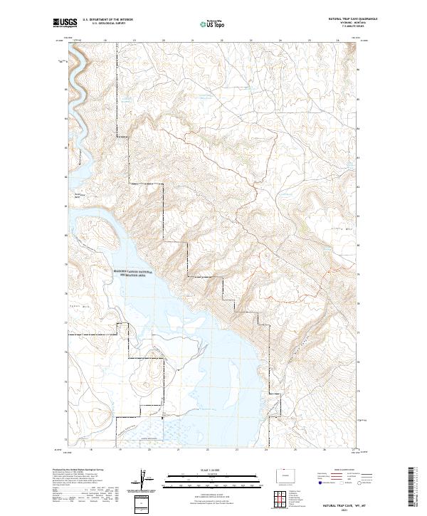
2021 Map of Natural Trap Cave
USGS Topo · Published 2021About this map
Bighorn Lake and the dramatic canyonlands of the Bighorn Canyon National Recreation Area dominate this landscape along the Wyoming and Montana border. The map documents a rugged terrain defined by significant vertical relief, including Sykes Mtn and Little Mtn, which overlook the winding waters of the canyon. A network of specialized access routes, such as the Yellowtail Habitat Road and Habitat Burn Roads, reflects the area's management for wildlife and conservation.
Find a feature on this map
23 named features on this map. Tap any name to fly to it.
Don’t see what you’re looking for? This feature index may not catch every label — zoom into the map to look around manually.
Map Details
Editions of this 2021 Natural Trap Cave Map
This is the sole edition of this map. No revisions or reprints were ever made.
Other maps of this area

1954 · Billings
USGS Topo · 1:250,000

1955 · Cody
USGS Topo · 1:250,000

1957 · Billings
USGS Topo · 1:250,000

1958 · Billings
USGS Topo · 1:250,000

1958 · Cody
USGS Topo · 1:250,000

1962 · Cody
USGS Topo · 1:250,000

1964 · Kane
USGS Topo · 1:24,000

1964 · Two Point
USGS Topo · 1:24,000
1964 · Simmons Canyon
USGS Topo · 1:24,000

1964 · Lovell Lakes
USGS Topo · 1:24,000