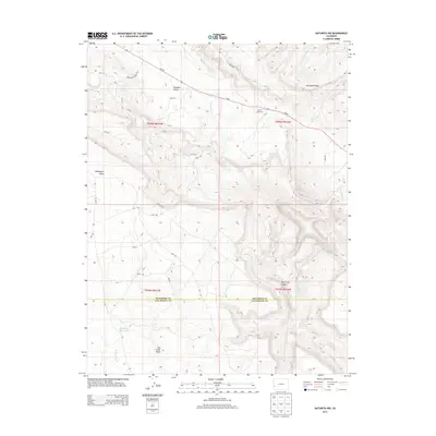
2013 Map of Naturita NW
USGS Topo · Published 2013About this map
Paradox Valley and Monogram Mesa anchor this landscape along the border of Montrose and San Miguel counties. The 2013 survey illustrates a high-desert environment defined by significant topographic relief, where the steep incline of Sawtooth Ridge overlooks the lower reaches of Dry Creek Canyon. Water management is critical in this arid region, as evidenced by Spectacle Reservoir situated within the Dry Creek Basin. Transportation is largely dictated by the terrain, with Co-90 cutting across the valley floor while more utilitarian paths like the Monogram Truck Rte and numerous numbered local roads, such as ee17 RD and hh19 RD, provide access to the surrounding plateaus. A small human-made landmark, Corral Number 2, stands as a solitary marker of livestock ranching operations in the remote backcountry east of the Paradox drainage.
Find a feature on this map
29 named features on this map. Tap any name to fly to it.
Don’t see what you’re looking for? This feature index may not catch every label — zoom into the map to look around manually.
Map Details
Editions of this 2013 Naturita NW Map
This is the sole edition of this map. No revisions or reprints were ever made.
Other maps of this area

1916 · Paradox Valley
USGS Topo · 1:125,000

1922 · Paradox Valley
USGS Topo · 1:125,000

1948 · Bull Canyon
USGS Topo · 1:24,000

1948 · Uravan
USGS Topo · 1:24,000

1948 · Hamm Canyon
USGS Topo · 1:24,000

1948 · Naturita NW
USGS Topo · 1:24,000

1948 · Gypsum Gap
USGS Topo · 1:24,000

1949 · Bull Canyon
USGS Topo · 1:24,000

1949 · Davis Mesa
USGS Topo · 1:24,000

1949 · Gypsum Gap
USGS Topo · 1:24,000