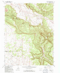
1994 Map of Naturita NW
USGS Topo · Published 1994About this map
The Department of Energy Uranium Reserve dominates the northwestern portion of this landscape, reflecting the intensive mineral exploration and extraction history of the Colorado Plateau. This area is characterized by steep elevation changes between the high Monogram Mesa and the expansive Paradox Valley below. Evidence of mid-to-late 20th-century industry is visible through multiple mining operations, including the Thunderbolt Mine, an Open Pit Mine, and various Mine Dump sites.
Find a feature on this map
14 named features on this map. Tap any name to fly to it.
Don’t see what you’re looking for? This feature index may not catch every label — zoom into the map to look around manually.
Map Details
Editions of this 1994 Naturita NW Map
This is the sole edition of this map. No revisions or reprints were ever made.
Other maps of this area

1916 · Paradox Valley
USGS Topo · 1:125,000

1922 · Paradox Valley
USGS Topo · 1:125,000

1948 · Bull Canyon
USGS Topo · 1:24,000

1948 · Uravan
USGS Topo · 1:24,000

1948 · Hamm Canyon
USGS Topo · 1:24,000

1948 · Naturita NW
USGS Topo · 1:24,000

1948 · Gypsum Gap
USGS Topo · 1:24,000

1949 · Bull Canyon
USGS Topo · 1:24,000

1949 · Davis Mesa
USGS Topo · 1:24,000

1949 · Gypsum Gap
USGS Topo · 1:24,000