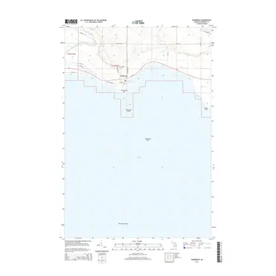
2014 Map of Naubinway
USGS Topo · Published 2014About this map
Naubinway sits at the northernmost point of Lake Michigan, serving as a distinct harbor community where the timber-rich Upper Peninsula meets the Great Lakes shoreline. This 2014 survey details the local infrastructure along Us-2, including the Naubinway Cem and a network of streets like Center St and Lake St that define the settlement's core. The map highlights the transition from terrestrial forests to maritime hazards, documenting several navigationally significant features such as Naubinway Reef, Naubinway Island, and the larger Millecoquins Reefs further offshore.
Find a feature on this map
32 named features on this map. Tap any name to fly to it.
Don’t see what you’re looking for? This feature index may not catch every label — zoom into the map to look around manually.
Map Details
Editions of this 2014 Naubinway Map
This is the sole edition of this map. No revisions or reprints were ever made.
Other maps of this area

1931 · Gould City NE
USGS Topo · 1:31,680

1931 · Gould City SE
USGS Topo · 1:31,680

1931 · Gilchrist NE
USGS Topo · 1:31,680

1931 · Gilchrist NW
USGS Topo · 1:31,680

1954 · Sault Sainte Marie
USGS Topo · 1:250,000

1955 · Hog Island
USGS Topo · 1:62,500

1955 · Cheboygan
USGS Topo · 1:250,000

1956 · Sault Sainte Marie
USGS Topo · 1:250,000

1957 · Sault Sainte Marie
USGS Topo · 1:250,000

1958 · Cheboygan
USGS Topo · 1:250,000